


23 JACKSON, Cass County, Indiana
About
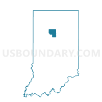
Outline

Summary
| Unique Area Identifier | 576541 |
| Name | 23 JACKSON |
| County | Cass County |
| State | Indiana |
| Area (square miles) | 29.51 |
| Land Area (square miles) | 29.49 |
| Water Area (square miles) | 0.02 |
| % of Land Area | 99.93 |
| % of Water Area | 0.07 |
| Latitude of the Internal Point | 40.60927690 |
| Longtitude of the Internal Point | -86.21467850 |
Maps


Graphs
Select a template below for downloading or customizing gragh for 23 JACKSON, Cass County, Indiana


Neighbors
Neighoring Voting District (by Name) Neighboring Voting District on the Map
- 19 DEER CREEK, Cass County, IN
- 27 TIPTON 1, Cass County, IN
- 28 TIPTON 2, Cass County, IN
- 32 GALVESTON, Cass County, IN
- CLAY 01, Howard County, IN
- CLAY 03, Howard County, IN
- DEER CREEK, Miami County, IN
- ERVIN 01, Howard County, IN
- PIPE CREEK 04, Miami County, IN
Top 10 Neighboring County Subdivision (by Population) Neighboring County Subdivision on the Map
- Pipe Creek township, Miami County, IN (6,294)
- Deer Creek township, Miami County, IN (4,839)
- Clay township, Howard County, IN (3,885)
- Jackson township, Cass County, IN (2,876)
- Tipton township, Cass County, IN (2,490)
- Ervin township, Howard County, IN (2,227)
- Deer Creek township, Cass County, IN (912)
Top 10 Neighboring Place (by Population) Neighboring Place on the Map
Top 10 Neighboring Unified School District (by Population) Neighboring Unified School District on the Map
- Maconaquah School Corporation, IN (15,358)
- Northwestern School Corporation, IN (8,695)
- Southeastern School Corporation, IN (8,447)
Top 10 Neighboring State Legislative District Lower Chamber (by Population) Neighboring State Legislative District Lower Chamber on the Map
- State House District 38, IN (66,895)
- State House District 32, IN (63,192)
- State House District 24, IN (60,089)
- State House District 30, IN (57,655)
Top 10 Neighboring State Legislative District Upper Chamber (by Population) Neighboring State Legislative District Upper Chamber on the Map
Top 10 Neighboring 111th Congressional District (by Population) Neighboring 111th Congressional District on the Map
Top 10 Neighboring Census Tract (by Population) Neighboring Census Tract on the Map
- Census Tract 9529, Miami County, IN (5,537)
- Census Tract 9527, Miami County, IN (4,771)
- Census Tract 9518, Cass County, IN (3,972)
- Census Tract 103, Howard County, IN (3,830)
- Census Tract 104, Howard County, IN (3,796)
- Census Tract 9519, Cass County, IN (3,788)